
Find accommodation in Rossleithen for a ski vacation
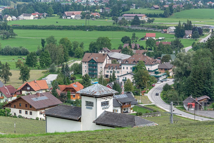 Die Ortschaft Schweizersberg ist ein Teil der Gemeinde Roßleithen in Oberösterreich.
Photo: Isiwal via Wikimedia Commons, CC BY-SA 4.0
Die Ortschaft Schweizersberg ist ein Teil der Gemeinde Roßleithen in Oberösterreich.
Photo: Isiwal via Wikimedia Commons, CC BY-SA 4.0
Brief facts on the topic
Rossleithen is located in the Kirchdorf an der Krems district in Upper Austria.
The municipality comprises six localities: Roßleithen, Pichl, Rading, Schweizersberg, Pießling and Mayrwinkl.
Rossleithen lies in the Garstnertal between the Sengsengebirge and the Warscheneck range and belongs to the Pyhrn-Priel region.
Rossleithen should not be broadly equated with an immediate lift location at the Hinterstoder-Höss ski area. For searching accommodation, the exact locality within the municipality is therefore important.
Baumschlagerreith and Teichschloß are geographical reference points in the wider area, not automatically destinations within Rossleithen.
Rossleithen between municipality and ski area
Rossleithen is a municipality in Upper Austria in the Kirchdorf an der Krems district. Its landscape setting is defined by the Garstnertal between the Sengsengebirge and the Warscheneck range. The place name is therefore helpful for regional orientation, but does not by itself describe the location of a specific accommodation.
For a ski vacation at the Hinterstoder-Höss ski area, you should therefore distinguish between the municipality of Rossleithen and the specific ski area location. The municipality name is not proof of proximity to lifts or slopes. What matters is which of the six localities the offer is in and what actual connection you plan for your ski day.
Check the accommodation location specifically
When looking for accommodation in Rossleithen, you should check the exact locality and the specific location within the municipality. Then match this information to your planned connection to the Hinterstoder-Höss ski area. The municipality name alone does not indicate an immediate lift location.
For orientation in the wider area, you can compare Rossleithen with Kirchdorf An Der Krems as well as with Spital Am Pyhrn, Vorderstoder, Hinterstoder and St. Pankraz. These pages help with spatial classification; however, the respective name does not imply anything about routes, offers or accommodation features.
Landscape setting and wider surroundings
The Garstnertal between the Sengsengebirge and the Warscheneck range forms the landscape setting of the municipality. This classification describes Rossleithen itself; no concrete winter offers or routes to individual facilities are inferred from it.
Baumschlagerreith lies in the wider area as a geographical reference point approximately 14.7 kilometers away in a straight line. Teichschloß lies in the wider area approximately 39.7 kilometers away in a straight line. Both figures are approximate straight-line distances and not driving distances; they say nothing about the location within Rossleithen, opening status, accessibility or specific activities.
The key decision for your accommodation in Rossleithen is therefore: Does the specific locality suit your planned connection to the ski area? Compare the exact accommodation location with your personal planning.
Check prices, availability and amenities for your travel dates directly on Booking.com.
View accommodations and offersAdvertisement · Partner link to Booking.com
