
Azuga: Sorica, Cazacu and Mountain Trails
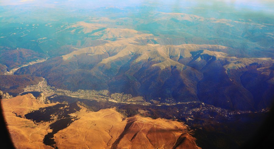 File:Aerial photograph looking east, showing area from Azuga to Sinaia, Prahova County, Romania.jpg
Photo: Joe Mabel via Wikimedia Commons, CC BY-SA 4.0
File:Aerial photograph looking east, showing area from Azuga to Sinaia, Prahova County, Romania.jpg
Photo: Joe Mabel via Wikimedia Commons, CC BY-SA 4.0
Winter
Azuga is home to the Sorica ski slope. It is 2,100 m long, of medium difficulty, homologated by FIS and ANT, and equipped with night lighting and artificial snowmaking. The Cazacu ski slope is 1,920 m long, of medium difficulty, and has an elevation difference of 530 m.
The operator, Azuga Resort, offers online purchases of Telegondola tickets. The Telegondola provides access to the Sorica ski slope and the mountain hiking trails. Near the Cazacu ski slope, there are additional cross-country ski trails and a snowboarding course with a total length of 10 km.
The various disciplines can be incorporated into your daily itinerary while remaining clearly distinguishable as different forms of skiing, cross-country skiing, and snowboarding. The Azuga Trail Race mountain running competition has been held every October since 2012 in the Baiului Mountains around the Sorica ski slope in Azuga.
When searching for a ski hotel in Azuga, you can compare travel dates, room categories, and cancellation policies on the offer pages. You can also specify which period and type of room match your personal travel plans; these three details provide a clear basis for comparing offers.
Hiking Trails
The mountain route begins at Azuga railway station and leads via Vârful Grecului to Cabana Diham in the Bucegi Mountains. It takes approximately 2½ hours and is classified as moderately difficult.
Another route runs from Azuga via Vârful Clăbucetul Taurului to Cabana Gârbova in the Baiului Mountains. It takes 3–3½ hours and is classified as moderately difficult to difficult.
A route leads from the base of the Sorica ski slope via Captare de Apă to Cabana Gârbova. It takes 1–1½ hours and is marked with a blue dot. The stated walking times and difficulty levels make it easier to compare the trails.
Nature
The vegetation in Azuga includes forest vegetation up to an elevation of approximately 1,400–1,500 m and alpine vegetation above the upper tree line from approximately 1,600–1,650 m.
History
The monument to the heroes of the 1877–1878 War of Independence was erected in the center of Azuga in 1905. It honors the eighth Dorobanți Company from Prahova and the fallen sons of the municipality.
The Holy Trinity Church in Azuga was built in 1902–1903; a large part of the construction costs was covered by the royal family.
The World War I Heroes' Cemetery was established in 1920 and covers 2,000 m², containing 160 soldiers' crosses and three wooden memorial crosses.
In Azuga, houses from the 19th and 20th centuries are designated as historical monuments.
Cycling Routes
A circular cycling route leads from Azuga via the Sorica ridge line, Baiu Peak, Poiana Țapului, Bușteni, Zamora, and Azuga Spital, returning to Azuga.
A moderately difficult circular cycling route leads from Azuga through the Azuga Valley and the Limbășel Valley, returning to Azuga.
Further destinations: Sinaia, Buşteni.
Back to the main travel overview: Prahova.
More about the destination
Relevant information for planning your trip:
Check prices, availability, and amenities for your travel dates directly on Booking.com.
View accommodations and offersAdvertisement · Affiliate link to Booking.com
