
Verrès: Castles, Hiking Trail and Mountain Destinations
Accommodation in Verrès
Castles and History
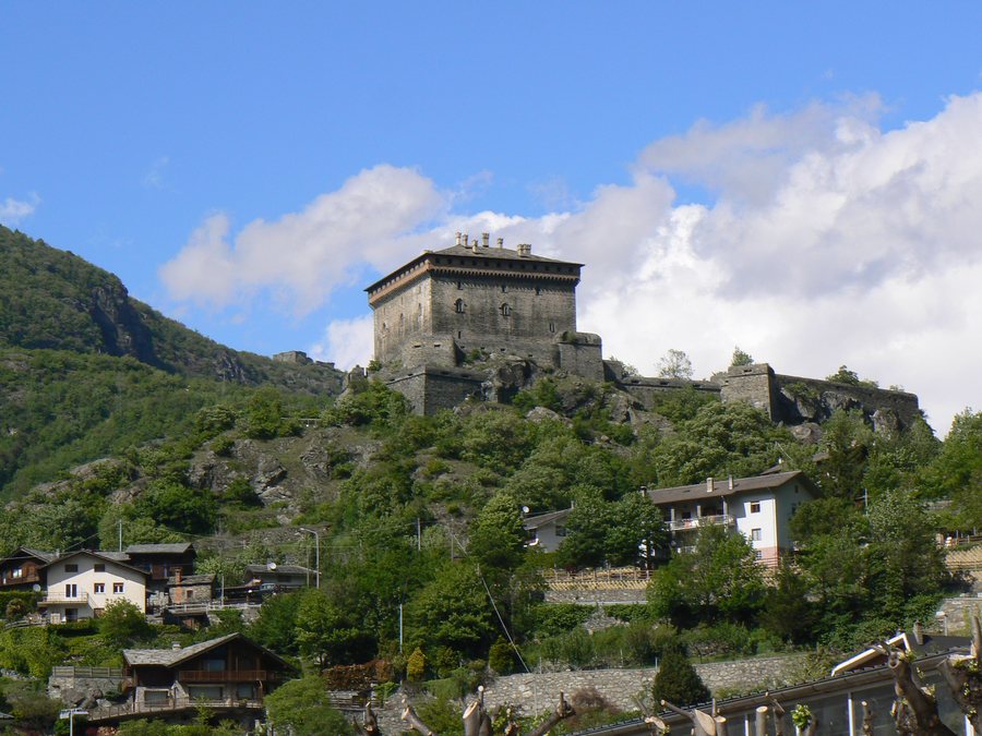
Castello di Verrès, a castle in the vicinity of Verrès, was built by Iblet de Challant as a pioneering castle in a single building. An inscription records that he began the work in 1390. Castello di Verrès stands on a rocky promontory above the Evançon mountain stream and controls the entrance to the Challand-Ayas Valley.
Castello di Issogne, a castle, is located in the vicinity of Verrès. Castello di Saint-Germain, also a castle, is likewise located in the vicinity of Verrès. Castello di Chenal, a castle, is also located in the vicinity of Verrès.
Today's parish church of Saint-Gilles was built in 1775 on the remains of an earlier Romanesque church. The Saint-Gilles complex also includes a Gothic chapel with a carved trefoil-shaped stone window and a Gothic vault. The Historic Carnival of Verrès was founded in 1949 during the carnival season to reenact a traditional event.
Hiking Trail to Croce di Saint-Gilles
The hiking trail from Verrès to Croce di Saint-Gilles begins at Piazza René de Challand. It passes the collegiate church of Saint-Gilles and continues into the “Borna de Laou” arboretum. The trail is classified as difficulty level E – hiking, is recommended from May to October, has an elevation gain of 312 metres and is 1,449 metres long. When hiking from Verrès to Croce di Saint-Gilles, you can consider the route length of 1,449 metres and the elevation gain of 312 metres separately when planning your day: the length describes the extent of the trail, while the elevation gain describes the ascent. May to October is stated as the recommended period; E – hiking is specified as the difficulty level of the particular route.
The order of the waypoints is relevant when planning breaks: the starting point, collegiate church and arboretum come before Croce di Saint-Gilles.
Croce di Saint-Gilles stands on a highly scenic rocky hilltop that is visible from the village of Verrès. For orientation, Croce di Saint-Gilles, visible from the village of Verrès, can serve as a landmark in the local landscape, while the trail itself begins at Piazza René de Challand.
Arboretum and Natural Surroundings
The Borna di Laou arboretum can be reached on foot from Verrès. In the Borna di Laou arboretum, information boards identify the vegetation using botanical names as well as the Italian and French names.
Col di Courtil, a mountain, is located in the vicinity of Verrès. Mont Lyan, a mountain, is also located in the vicinity of Verrès. Monte Obré, a peak, is located in the vicinity of Verrès. Tète de Cou, a mountain, is likewise located in the vicinity of Verrès.
Along the Dora Baltea
Verrès is a stage of the Via Francigena cycling route along the Dora Baltea.
Further destinations for your travel planning: Châtillon, Sarre, Fénis Ao, Rhêmes-Notre-Dame, Gressoney-La-Trinité, Valgrisenche, Valsavarenche, Valtournenche
To the higher-level travel overview: Aosta Valley.

