
Earthquake in New Zealand
A magnitude 6.3 earthquake struck New Zealand’s South Island at 12:51 p.m. local time on February 22, 2011. The epicenter was about ten kilometers southwest of Christchurch, the capital of the Canterbury region, at a depth of 4,000 meters. Initial reports said at least 65 people had been killed, with many more trapped under rubble. "We are probably witnessing New Zealand’s darkest day," Reuters quoted New Zealand Prime Minister John Key as saying. The earthquake caused the worst devastation in New Zealand in 80 years. In 1931, more than 250 people were killed in a magnitude 7.9 earthquake in Hawke’s Bay.
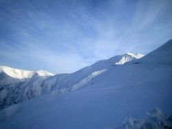 Die Berge der Südlichen Alpen von Neuseeland sind durch die Verschiebungen von tektonischen Platten entstanden, die jetzt auch Ursache für das schlimme Erdbeben in Christchurch waren.
Date: 30/09/2026
With a population of 400,000, Christchurch is New Zealand’s second-largest city. The earthquake struck around midday, while residents were at work or out on the city streets. Numerous office and commercial buildings collapsed in downtown Christchurch, including an office building that housed an international language school. Ongoing aftershocks are hampering rescue efforts and continue to put rescuers’ lives at risk. So far, no information is available about foreign victims of the earthquake. “Sadly, we expect that tourists and foreign students may also have been affected,” Deputy Prime Minister Bill English was quoted as saying.
The earthquake’s effects reached the Tasman Glacier in Mount Cook National Park, 250 kilometers southwest of Christchurch. According to the Associated Press, 30 million tons of ice broke off the Tasman Glacier as a result of the earthquake.
Background: Earthquakes in New Zealand
All of New Zealand lies on the Pacific Ring of Fire, one of the most tectonically active areas on Earth. One result of this tectonic activity is one of the world’s most breathtaking landscapes—the Southern Alps („Southern Alpes“). Film fans will recognize many landscapes in New Zealand’s Southern Alps as locations from The Lord of the Rings. The Southern Alps were formed because the movements of the Pacific and Australian plates along the Alpine Fault are not exactly parallel, but slightly offset. Over millions of years, this has pushed up the mountains of the Southern Alps.
Minor earthquakes are considered normal throughout New Zealand (more than 14,000 earthquakes are recorded each year), but major earthquakes (magnitude 7.0 or higher) are not an everyday occurrence. Nevertheless, as recently as 2009, a very powerful magnitude 7.8 earthquake was recorded far to the south of the Southern Alps, in Fiordland National Park. Christchurch was also affected by a magnitude 7.1 earthquake in 2010. At the time, only a few injuries were reported, although there was extensive property damage.
The region around Christchurch is virtually encircled by the Southern Alps. Within a one- to two-hour drive of New Zealand’s second-largest city are some of the country’s best-known ski areas, including Mount Hutt, Temple Basin, Craigieburn, Broken River, Cheeseman, Mount Olympus and Porters. The ski resorts have not been affected by the current earthquake, and New Zealand’s ski season does not begin until July. The ski areas on New Zealand’s South Island are considered a real hidden gem because of their natural beauty. While celebrity buzz and après-ski are relatively insignificant at the small ski resorts of the Southern Alps, the areas are regarded as a mecca for heliskiing. Earthquakes are the price of these ski areas’ location in New Zealand.
Markus Lenk
Photo: Christoph Boddem
